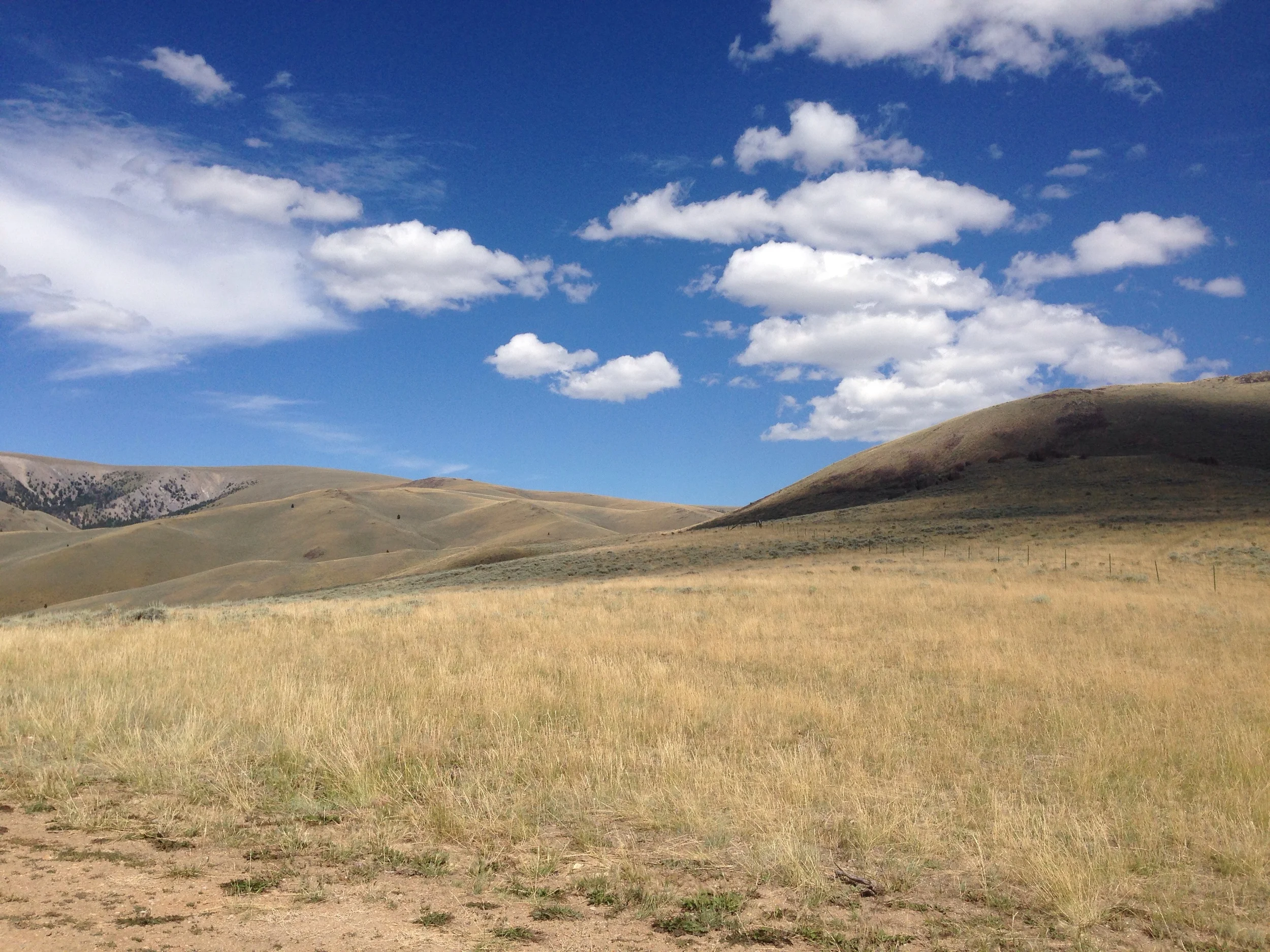
An Ode to the Mosh Pit and the Front Roll

I'm about 18 days into the trip at this point, and I've found two pieces of Blackburn gear in particular to be super rugged and helpful. 

Blackburn OUTPOST Top Tube Bag

Ranger edition Blackburn top tube bag

Ranger edition Blackburn top tube bag

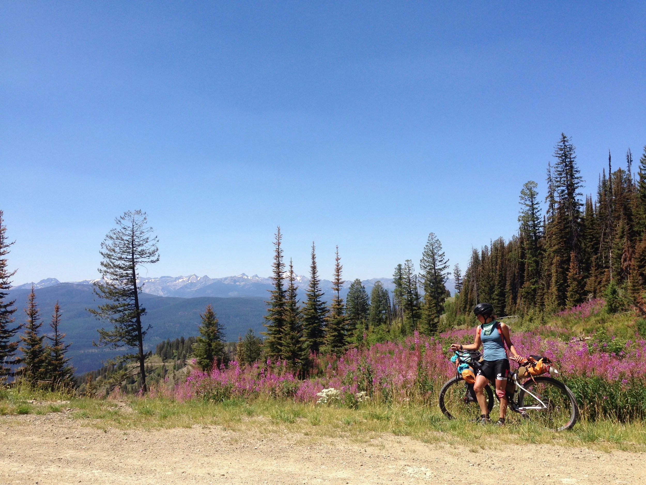
​The Blackburn top tube bag, which I have fondly nick-named "the mosh pit".  It got its name from its ability to hold many different things in a tight space all in a "front and center" location, which was born from a word-smithing session on a particularly long mountain pass in Montana.

Top mesh fits an iPhone5 perfectly 

Top mesh fits an iPhone5 perfectly 

It stays put on the top tube, conveniently holds my iPhone5 in the mesh netting on top (although it might not fit a Samsung Galaxy or iPhone6), holds various snacks, sunglasses, cords, and other miscellaneous items inside.  It is fairly water resistant, which means that it's dry inside during a rain shower, and damp after a night of being left out in a deluge.  It also has two tiny side pockets, which are convenient for similar tiny things.

Inside: sunglasses, pen, cycling gloves, snacks (not pictured) 

Inside: sunglasses, pen, cycling gloves, snacks (not pictured) 

Right now, it holds my Phone in the mesh netting when it's not raining, the Sinewave Cycles Revolution (rectifier for my generator hub) in the tiny zipped pocket, my lip balm and spare change in the other non-zipped tiny pocket, my glasses or sunglasses, a pen, the charger cord for my iPhone and bluetooth Omaker Speaker, and a revolving assortment of other things such as Giro cycling gloves, snacks, and compass.

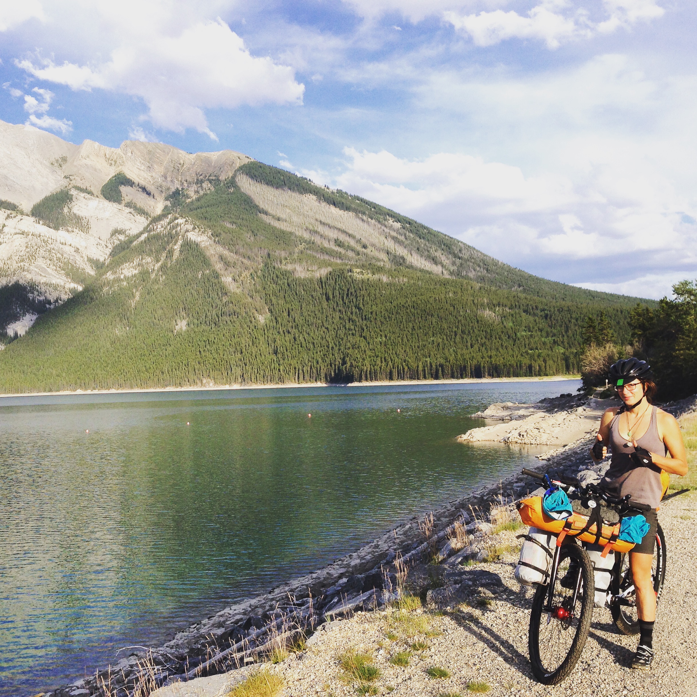
Blackburn OUTPOST Front Roll

The other piece of bikepacking gear that has been really awesome is the Blackburn Outpost Front Roll.  The front roll dry bag holds my 20 degree sleeping bag (not a small item), my Klymit X-frame sleeping pad (packs a little bigger than a soda can), inflatable pillow, Platypus filter, bike repair kit, and packable day-bag.  It's stuffed to the gills for sure, but it holds firm on the wild, rocky descents omnipresent here on the Divide route.

Front roll CHILLIN near the first water feature in Wyoming.  

Front roll CHILLIN near the first water feature in Wyoming.  

The front roll itself also is a good place to store my rain jacket, the bear spray, LUNA sandals and the ACA map.  With the compression strap that hooks around your stem, the roll holds firmly in place while also allowing you to strap on other gear.

Both of these items I am using are the next generation prototypes of the OUTPOST bags.  You can't buy them just yet, but check back here on Blackburn's website for when they are available.

Montana in Review

At the top of a pass right before Seely Lake

At the top of a pass right before Seely Lake

At this point, I'm more than halfway through Montana in mileage. I only have about 100 miles left. As such, I feel ready to give a recap of the state and the ACA route through it.

The Sky

image.jpg

First of all, the sky is big. No doubt about it. The mountains and valleys are spaced such that you often have a clear view for many miles. I find this to be extremely satisfying, especially when I can see a rainstorm 6 miles away and get ready for it. 

The People

We met Ryan Thomas in Butte, one of the nice Montanins who is planning on doing the Tour Divide race next year.  

We met Ryan Thomas in Butte, one of the nice Montanins who is planning on doing the Tour Divide race next year.  

The people! I really have never met nicer people. This was especially exemplified in Helena. Even before Helena, I met a woman in the town of Ovanado, who asked what we were doing and gave me her business card telling us "if we needed anything, place to stay, a shower, etc.", to call her. She was from Helena. Before we went to sleep in town, we got three, un-solicited offers to stay with someone in town. (This is actually really convenient because the nearest campgrounds are outside of town by a few miles.). We ended up staying with the owner of the Great Divide Cyclery, Dan,  and his lady, Lani. They were truly awesome. Also, if you eat lunch at Taco Del Sol, it's on the house if you are doing the divide. Who knew!?


The terrain and the elevation

Mountains of Montana

Mountains of Montana

I've only ridden about 750 miles in the trip yet, but the passes have been numerous in Montana. Doing 60-70 miles a day, there is at least one, maybe three passes in a day. So this means between 1,500' and 2,000' of climbing over a distance of three to seven miles at any one time. One day we crossed the path of the Contintal Divide three times for a whopping yotal of 6,000' of elevation gain that day.  For the people who race the Tour Divide, I don't envy the fact that you probably do twice this. 


Cattle country

 It seems that the northern sections of Montana were a little more pristine in terms of forest; although there was a fair amount of logging. After Lincoln, more and more of the landscape is shaped by cattle grazing, meaning that much of what you see is grazed-over land, stumps, and cattle fence. Compared to the national forests of Canada, the National forest land in Montana is pretty dismal. 

The Vastnes

image.jpg

​The mountains and valleys. To balance out the statement above, I just rode through the biggest, most surreal place I've ever been. My pictures don't do it justice. The wilderness area between the Tendoy and Beaverhead Mountains near Big Sheep Creek was like being in a level of inception where there is only mountains, sky, and valley. All covered in low sage brush, sparse grasses, and the occasional tree. Toward the town of Dell, the creek and road winds through folds of mountains, crumbling cliffs with pockets of swallow nests, and sage brush the size of small trees. Get out there, it's beautiful. 

Lawns

Montana lawns. 

Montana lawns. 

 It seems that a select few of Monanatans love their lawns. Every so often, you'll see a brilliant patch of green in a sea of earthy golden browns. I've been told that this is mostly because people have their own well water, the supply of which does not seem to be an issue. It is an interesting sight, as people's houses are a small piece of a usually otherwise very large plot of land. 


As I prepare to leave Montana and enter Idaho, I think that I have enjoyed the towns we've passed through... Some touristy, some small-town, but all a welcome sight. The mountain passes have been difficult but gorgeous, and fun on the descent. If I came back, I'd do it with an unloaded bike and spend some time exploring the singletrack around Whitefish and Helena. 


A Note about Navigation

Staying found on the Great Divide Mountain Bike Route  has been easier than I expected.  But perhaps it's because I followed the Adventure Cycling Association's recommendation of having multiple modes of navigation handy.   

Cyclometer

Strada cateye wired cyclometer  

Strada cateye wired cyclometer  

I am running a Cateye Strata Cadence cyclometer, which is a wired version of their Strata. Using wired technology allows for a much longer battery life in the cyclometer. Installation was easy, and I've found it very easy to use. You can customize the wheel diameter of your bike to make sure your distance readings are accurate, which is very important for following the ACA maps. However, I've found that being a few centimeters off is acceptable as long as you are aware of the difference between the ACA map mile and your cyclometer. Not to mention, there's no way to "add" miles to the Cateye distance reading (like in a car you have Distance 1, Distance 2, and the Odometer).  But as long as you zero out your trip distance at a reasonable mile marker, adding the miles in your head is easy. 

An example:  the ACA map says at mile 150.3 you will "cross a cattle guard", you might zero out your computer then and just continue to mentally add 50 miles to the rest of the directions that day.  However, I wouldn't recommend using a generic mile marker like this, because the maps tend to arbitrarily chose one cattle guard or railroad tracks out of multiple. So something more significant like signs, landmarks, or obvious intersections are better.  

GPS

Without going off the deep end, I'm going to say that the Garmin eTrex20 would've been a good device if I hadn't accidentally deleted the base map using Garmin's own software.  Call me stupid, but I don't think one should be able to delete the basemap. Additionally, to get the topo maps for the divide, it would've cost an additional $200. (Because really the basemap isn't useful enough for navigation in back country.) So with a completely black background, I downloaded the waypoints into the GPS and then proceeded to find a better option.  


image.jpg

The Gaia app for the iPhone seemed to fit the bill. I took the Garmin with me just in case, but I haven't used it once.  The Gaia app takes a little learning to use it effectively, but it's very effective. You can download sections of an already loaded topo map for offline use, load the entire GDMBR routes and services waypoints, and it will be able to locate you on the map without cell phone coverage. 

So for $30, I get everything the Garmin would've offered for $400.00. A smart phone uses the same GPS satellites as a Garmin device.  

The only trick is to keep the cell phone charge, which hasn't been a problem so far wth the generator hub.  

I am keeping the GPS around in case it's too hot in Wyoming for the iPhone to stay on.  

Maps

The Adventure Cycling Association's naps are excellent if you want to follow their route exactly.   The maps will inidcate some alternatives to particularly difficult sections, and will give some detail on additional roads but not enough to rely on. Hence, the GPS/Gaia app. 

Here's to staying found. 

Rest Days and Switching to Flats

I've been an athlete for a long time... long enough to know that one of the easiest ways to injure yourself is to do too much too quickly.  However, I'm also an unreasonably optimistic person.  I figured averaging 50 miles a day would be alright, knowing that I'd get about 1.5 rest days after the first 6 days and another rest day every other week or so.  

A surprising amount of people lived in the Kootenai National Forest; the section of trail just before Whitefish

A surprising amount of people lived in the Kootenai National Forest; the section of trail just before Whitefish

In the last two days of the Canada to Whitefish, Montana segment, my knee started to give me some warning pains. 

If I had to do it over again, I would change some things: 

  1. Plan for a less-than-average pace for the first week - Between pack adjustments, last minute sight-seeing, and getting used to biking with a 50-60 lb. bike, you will want to plan for some shorter days.  If you've been training for this (with weight), obviously you know what you're getting into.  But if you're like me and spend most of your pre-ride time figuring out how to do the damn trip, you probably weren't training too much. 
  2. Be more diligent about stretching/strengthening every day - The best way to avoid injury is to diversify your workouts and make sure all your muscle groups are getting activated. It's REALLY hard to do at the end of a long day of biking, especially in inclement weather, but there's no excuse for prevention. 
  3. Ride without a schedule - Don't get me wrong, I'm super grateful for all my riding buddies along the way, but I know that it would be easier to adjust for on-the-trail changes if there were no deadlines. Even simple things like "hey this lake is really cool; let's hang out here for the rest of the day" become more attainable if you don't have anywhere to be in 5 days.  Maybe this sounds obvious as well, but coming from a fast-paced, hard-working, deadline-riddled life on the East Coast, this is a new concept for me.  
  4. Start with flat-clipless pedals - It's a fairly common fix for people with knee pain to ride with flat pedals. It allows for the foot to go wherever it wishes to allievate knee pain. I wish I would've started with the pair I had laying at home instead of paying to switch later.

Fortunately, while in Whitefish, I was able to see an awesome Physical Therapist, Jay Schraver.  He helped diagnose me with a standard case of over use and a slightly errant patella.  So far, my stretched and taped knee is feeling better.

Getting taped up at Northern Physical Therapy

Getting taped up at Northern Physical Therapy

I also visited Glacier Cyclery and got some flat-clipless hybrid pedals so that my foot could go wherever it wished to alleviate pain.  

Glacier cyclery was really awesome when I stopped in. Recommended! 

Glacier cyclery was really awesome when I stopped in. Recommended! 

With another day of rest and making some adjustments to make my ride more efficient, I'll hopefully be back on it.

Pretty good pie at Lula's

Pretty good pie at Lula's

In the meantime, I ate way too much in Whitefish and soaked up the comforts of civilization with some warm showers, big breakfasts, I've-cream, non-camp coffee, and beers with friends.  In the realm of bikepacking, taking just 48 hours off from biking feels like an eternity and a supreme luxury. 

Bikes stand waiting while we sipped beers by Whitefish lake

Bikes stand waiting while we sipped beers by Whitefish lake

Adjusting to bikepacking life

image.jpg

The first 5 days on the bike have been amazing, but getting used to life on a mountain bike is no walk in the park.  I'm as psyched as the next person to rip down washed out, barely-maintained roads after laboring up 2,000 feet in 5 miles with everything I need to eat, sleep, and survive in the wilderness... But, it takes an adjustment... Or many. 

Long ascents in a wild, remote places

Long ascents in a wild, remote places

Here are some of the trials and tribulations I wasn't necessarily thinking about pre-trip: 

  • Packing everything by weight so it fits nicely and hangs tight on rugged terrain (read: creek crossings, rocky wash outs, steep and fast pass descents);
  • Packing everything by frequency and order of use to avoid unpacking a whole bag just for one item (sounds obvious, but it takes a few days to figure out when you will need what items at what time of day);
  • Thinking ahead to pack non-ritualistic items on top (e.g., don't bury your passport the day you will cross a border);
  • Finding the ideal mix of the above mentioned items for optimal efficiency and minimal frustration; 
  • Remembering to eat according to output energy and time (I can forget to eat an appropriate amount during hard efforts, especially in jaw-droppings mountain ranges, which is never good 2 hours later); and
  • Remembering to have a good attitude in rainy conditions. Nothing rains harder on a good day that an afternoon/evening shower that soaks you and everything around you such that setting up camp becomes a delicate operation of segregation between wet and dry items. A joke and a some old fashioned sarcasm go a long way in these cases.  And I'm super thankful for a riding partner that can help me with that. :)


Hanging clothes and cooking dinner under a bridge during a long rain shower. 

Hanging clothes and cooking dinner under a bridge during a long rain shower. 


Some me things that have been working out really well so far:  

  • Reading the elevation profile enough to know roughly what to expect that day, but not tracking the feet left in a mountain pass. It might just be me, but sometimes I find that ignorance is bliss before a hard days bike ride. 
  • Really taking a good hard look at the landscape, and not just to take a picture. I want to be able to communicate my journey, but I also know that the experience is totally different without a lens between myself and the world.  
  • Wool, wool, wool - what they say about wicking, quick-dry, and odor-resistant is all true. Of course, it won't smell like clean laundry, but both my  Giro cycling jersey and my Inji toe socks have kept me feeling somewhat civilized.   
  • Blackburn Outpost Handlebar Roll - it may look like an awkward log when it's stuffed with my 20 degree bag, Klymit sleeping pad (rolls up to the size of a soda can!), inflatable pillow, Platypus water filter, and bike repair kit, but it holds firmly in place during the bumpiest descents. I found that tightening the cinch strap that encompasses the whole roll is key to keeping things in place. 
  •  Relevate Designs Feedbag - so this thing makes me blissfully happy, mostly because it is the like the kangaroo pouch I never had.  I mix up a bunch of different snack foods like dried cranberries, mangos, nuts, unwrapped starbursts, sweet sesame treats I found at a market in Chinatown, and whatever else... Then I have a grab bag of pick me ups between meals. 

Starting off in Canada

First things first, this place is gorgeous. Secondly, exploring by bike affords one ample time to look around at the slowly changing landscape.  The mountains are bigger than I could've imagined, the water is a blue color that awkwardly resembles the color of Gatorade Frost, and the air is so cool and crisp that it only makes sense to be outside. It's hard to explain the magic of this place.  You might just have to go yourself.

banffcampsite
lakemoraine

Day 1 of the trip was a little rough.  In the first 9 miles there were 3 adjustment stops to play with straps and tuck in loose items.  You learn really quickly riding on dirt and gravel trail how tight everything needs to be packed.  I threw stuff out, cut my toothbrush in half... you know, things that people do when they're exasperated. Anyway, I re-packed everything on the second morning, and found that all the gear held a LOT better... even as I cruised down some pretty gnarly trail.

onlyhalfatoothbrush
dustydorrien

The scenery was amazing, but it wasn't all smooth sailing.  About 15 miles on a VERY dusty Smith-Dorrien road left a thin film of gray dust all over myself, the bike, and inside my nostrils. It was a love/hate relationship.  The mountains were so beautiful, but the road was so painfully dry and dusty.

Getting ready to roll around Lake Minnewanka, near Banff

Getting ready to roll around Lake Minnewanka, near Banff

Surprising to note, there has been a lack of wildlife sightings.  Only the tiny critters (prairie dogs, squirrels, etc.) seem to be curious.  I guess that's fine for now, but I could deal with an elk sighting.  Especially as I sit here in the library of Elkford, CA.

Oh, BTW, while Alberta may win for having bigger mountains, British Columbia wins for having awesome, free, camping. In Alberta, you pretty much have to pay to breathe the air.

I'll be State-side in a day or two, but for now, am really really enjoying the wilderness of Canada.